In this Article
Introduction
The Future Mobility Living Lab trial was a collaborative effort between Minnovation, the City of Casey, and researchers from Federation University and Swinburne University, aimed at enhancing road safety and promoting sustainable urban mobility. By deploying Minnovation’s AlphaX Vision Object Detection Sensors at key intersections, the trial focused on understanding how pedestrians, cyclists, and vehicles interact, particularly vulnerable groups like children, the elderly, and those using mobility aids. This project aligned with the City of Casey’s strategies for fostering community safety, sustainable transportation, and leveraging cutting-edge technology to create a connected and inclusive environment.
Overview of Deployment and Methodology
The AI algorithms used in the trial were based on NVIDIA DeepStream, a powerful deep learning framework that enabled real-time analysis of video streams to classify and track multiple objects simultaneously. The system was capable of recognising vehicles, pedestrians, and cyclists, and making informed predictions about their likely paths and behaviours. DeepStream’s capabilities allowed the sensors to capture and analyse the complex interactions between mobility modes, providing valuable insights for improving road safety.
The trial involved installing AlphaX Vision sensors at three strategic locations: the roundabout at Amberly Drive and two locations on Ormond Road to cover the bus stop, school drop-off zone, and school crossings. The sensors were mounted on 2.4-metre-high poles to provide an optimal vantage point for tracking road users and accurately measuring distances between them.
In collaboration with Federation University and Swinburne University, advanced AI algorithms were utilised to track and classify different mobility modes, including vehicles, pedestrians, and bicycles, while anonymising the collected data to ensure privacy. An API was developed to provide the university researchers from both institutions with direct access to the data for deeper analysis and further insights.
Key Safety Findings
Mixed Mobility Mode Interactions
The primary goal of the trial was to monitor the interactions between various mobility modes and identify safety risks associated with mixed road usage. The data gathered during the trial provided the following key insights:
- High Vehicle Reliance: The sensors recorded 476,355 objects, of which 461,492 were vehicles, indicating a high reliance on automobiles. This volume of vehicle traffic presents challenges for promoting a safe, mixed-mobility environment and emphasises the need for encouraging alternative forms of transportation.
- Pedestrian and Bicycle Movements: Pedestrian movements accounted for 13,820, while bicycles and scooters combined represented 1,043 recorded movements. This disparity highlights the need for improved infrastructure and programmes that encourage walking and cycling as safe, viable alternatives to driving.
- Near Misses and Predictive Pathing: A critical safety observation was the occurrence of 1,015 near misses. These near misses were identified using predictive pathing powered by NVIDIA DeepStream. The AI algorithms tracked the movements of all detected objects, including vehicles, pedestrians, and bicycles, and projected their future paths to determine if any were likely to intersect. Incidents were ranked as high, medium, or low risk based on a matrix of likelihood and the potential consequence of the interaction. A near miss was defined as an instance where two objects, such as a vehicle and a pedestrian or bicycle, were likely to collide based on their predicted paths. These near misses were ranked as high, medium, or low risk, depending on the confidence level of the prediction and the potential consequence of the interaction. By utilising predictive pathing, the AI algorithms were able to track the movement of each object and predict potential collision points. This proactive approach allowed the system to identify when a pedestrian, cyclist, or vehicle was on a trajectory that could lead to a near miss, providing vital insights into road safety risks.
- Jaywalking Incidents: The sensors documented 74 instances of jaywalking, particularly around school zones and bus stops. Many of these incidents involved students disembarking from buses and crossing the road without using designated crossings. Such behaviours present significant safety risks that could be mitigated through targeted education and better enforcement of pedestrian safety measures.
School Zone Safety Observations
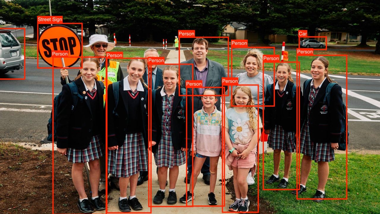
The trial also provided valuable insights into road safety within school zones. During school drop-off and pick-up times, vehicles slowed down by approximately 10 km/h, reducing the risk of incidents. The data indicated that driver behaviour around schools was largely responsible, with minimal instances of speeding or dangerous driving recorded. This reflects the effectiveness of existing measures and the community’s commitment to ensuring child safety.
However, pedestrian behaviour, especially among students, remained a concern due to jaywalking and crossing the road before vehicles had fully passed. Addressing these behaviours through education is essential to further enhancing school zone safety.
Mixed Mobility Challenges
The trial highlighted several challenges associated with interactions between different mobility modes—vehicles, pedestrians, and bicycles. The following key challenges were identified:
- Pedestrian-Vehicle Interactions: Although pedestrian activity was significantly lower compared to vehicle traffic, the risk of conflicts remained high. Near misses frequently occurred in areas where pedestrians crossed outside of designated crossings, increasing the likelihood of incidents.
- Bicycle Safety: Bicycles constituted a small proportion of total movements, highlighting a lack of cycling infrastructure and potential safety concerns among cyclists. To promote cycling as a practical mode of transport, it is crucial to develop safer pathways and integrate cycling more effectively with other road users.
- Vehicle Dominance: The dominance of vehicles on the road made it challenging to create a balanced mixed-mobility environment. The high speeds of vehicles, even if within speed limits, contributed to a higher potential for near misses with pedestrians and cyclists.
Recommendations for Improving Safety
1. Education Campaigns on Near Misses and Jaywalking
A targeted education campaign should be launched to address the causes of near misses and jaywalking incidents. Education focused on safe pedestrian practices, particularly in school zones, could significantly reduce jaywalking and associated risks. Engaging students, parents, and the wider community through schools would foster safer crossing habits.
2. Infrastructure Improvements for Active Mobility
To address the heavy reliance on vehicles, it is crucial to invest in better infrastructure for walking and cycling. Establishing dedicated and safe pedestrian and bicycle pathways will help encourage alternative forms of transport. Specific improvements could include extending the cycling network, adding protective barriers, and improving signage at key crossings.
3. Commendation of Responsible Driving in School Zones
Drivers in school zones demonstrated commendable behaviour, with minimal speeding and adherence to safety requirements. Recognising and praising this behaviour publicly—through council announcements or community campaigns—could serve to encourage continued responsible driving practices.
4. Promotion of Bicycle Usage
With only 1,043 bicycle and scooter movements recorded, efforts should be made to promote cycling through community engagement and enhanced cycling infrastructure. Safe bicycle routes and awareness campaigns can help shift the community’s reliance away from cars to more sustainable transport options.
5. Reliability in Hardware and Pre-installation Inspections
The trial experienced some setbacks due to early hardware failures, which were caused by the combination of an untested but higher-spec solar system and higher-spec cameras. These components were found to be incompatible, leading to system failures. The incompatibility between the upgraded solar system and the cameras resulted in disruptions, highlighting the importance of ensuring that components are fully compatible and tested before deployment. For future deployments, it is recommended to use tried-and-tested hardware to minimise disruptions. Additionally, conducting site visits before installation will ensure that planned sensor locations are viable, preventing last-minute changes due to outdated information.
Conclusion
The Future Mobility Living Lab trial, conducted in partnership with the City of Casey, Federation University, and Minnovation, provided valuable insights into the safety aspects of mixed mobility modes in urban environments. The trial highlighted critical safety challenges, including near misses, jaywalking, and the dominance of vehicles over active mobility modes.
Through the use of predictive pathing technology, the trial was able to identify potential safety risks before incidents occurred, offering a proactive approach to improving road safety. By promoting education, enhancing infrastructure, and encouraging collaboration between local councils, universities, and the community, we can create a safer, more balanced mobility environment in the City of Casey.
Continued collaboration between stakeholders and the community will be essential to addressing these challenges and moving towards a more sustainable and inclusive urban transport network.
References
Related Blog Posts
How Smart Cities Connect: Getting Started with Edge AI and IoT Technology
How to Get Started with Edge AI and IoT Technologies in Smart Cities: Overcoming Integration Challenges In recent years, the concept of smart cities has evolved from a futuristic Read More
5 Step Strategy: Ensuring Security and Privacy in 15-Minute Smart Cities
Introduction Ensuring security and privacy in 15-minute smart cities is a critical challenge as urban areas become increasingly connected through IoT and edge AI technologies. These cities aim to Read More
What is a smart city and the challenge of legacy systems
How to Get Started with Integrating Legacy Systems in Smart Cities Smart cities are transforming urban landscapes by leveraging technology to improve the quality of life for residents. However, Read More


